Welcome Visitor. First time here? Like what you see? Bookmark us for when you are bored, and check out 'top shots' and 'fantastic (editors choice)' in the menu above, you won't be dissapointed. Join our community! click here to sign up for an account today. Sick of this message? Get rid of it by logging-in here.


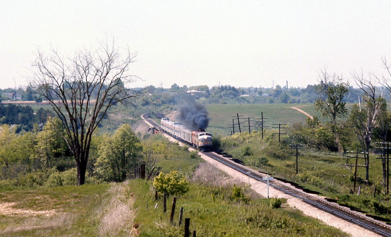
Under a cloud of MLW smoke from the trailing FPA2, The Canadian (#12) heads south after passing through Woodbridge, crossing over the Humber River bridge on Canadian Pacific's MacTier Sub. The train is approaching the white "Emery" mileboard sign, and the CN Halton Sub overpass northwest of Islington and Steeles from which this photo was taken. Sprawling farmer's fields line the right-of-way on both sides (with a private farm crossing a little further behind the rear "Park" dome-observation car).

The curve in the distance and Humber River bridge were part of the re-alignment of CP's MacTier Sub that took place circa 1907. The original Toronto, Grey & Bruce line curved through the valley of the river below, came to grade around the curve in the distance, and continued to Woodbridge on a more western alignment. The old Toronto Suburban Railway radial line from Weston to Woodbridge once ran through this area following the Humber River north, and also crossed below this bridge.

Today the MacTier Sub remains a busy CP freight corridor between Toronto and western Canada, but under VIA operation The Canadian was long ago shifted to CN routing in the southern Ontario area. Highway 407 ETR currently runs through the foreground of the photo parallel to CN's Halton Sub.
Copyright Notice: This image ©Bill Thomson all rights reserved.


Caption: Under a cloud of MLW smoke from the trailing FPA2, The Canadian (#12) heads south after passing through Woodbridge, crossing over the Humber River bridge on Canadian Pacific's MacTier Sub. The train is approaching the white "Emery" mileboard sign, and the CN Halton Sub overpass northwest of Islington and Steeles from which this photo was taken. Sprawling farmer's fields line the right-of-way on both sides (with a private farm crossing a little further behind the rear "Park" dome-observation car).

The curve in the distance and Humber River bridge were part of the re-alignment of CP's MacTier Sub that took place circa 1907. The original Toronto, Grey & Bruce line curved through the valley of the river below, came to grade around the curve in the distance, and continued to Woodbridge on a more western alignment. The old Toronto Suburban Railway radial line from Weston to Woodbridge once ran through this area following the Humber River north, and also crossed below this bridge.

Today the MacTier Sub remains a busy CP freight corridor between Toronto and western Canada, but under VIA operation The Canadian was long ago shifted to CN routing in the southern Ontario area. Highway 407 ETR currently runs through the foreground of the photo parallel to CN's Halton Sub.

Photographer:
Bill Thomson [715] (more) (contact)
Date: 06/00/1971 (search)
Railway: Canadian Pacific (search)
Reporting Marks: CP 4066 (search)
Train Symbol: CP 12 - "The Canadian" (search)
Subdivision/SNS: Emery - CP MacTier Sub (search)
City/Town: Vaughan (search)
Province: Ontario (search)
Share Link: http://www.railpictures.ca/?attachment_id=25781
Click here to Log-in or Register and add your vote.

10 Favourites
Photographers like Gold.Log-in or Register to show appreciation
View count: 2445 Views

Share this image on Facebook, Twitter or email using the icons below
Photo ID: 24632

Map courtesy of Open Street Map

Full size | Suncalc
Note: Read why maps changed. Suncalc.net for reference only.

All comments must be positive in nature and abide by site rules. Anything else may be removed without warning.

One Comment
  1. Great shot Bill.

Railpictures.ca © 2006-2023 all rights reserved. Photographs are copyright of the photographer and used with permission
Terms and conditions | About us