Welcome Visitor. First time here? Like what you see? Bookmark us for when you are bored, and check out 'top shots' and 'fantastic (editors choice)' in the menu above, you won't be dissapointed. Join our community! click here to sign up for an account today. Sick of this message? Get rid of it by logging-in here.


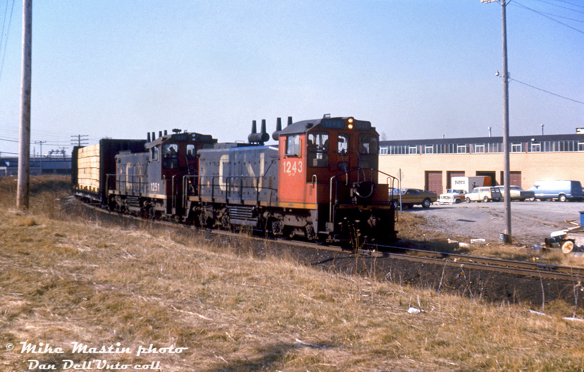
CN SW1200RS units 1243 and 1251 head up the southwest leg of the GECO Branch with a local freight to switch some customers, about to cross Milne Ave. in the industrial area surrounding the Kingston Sub in Scarborough.

The 3-mile GECO Branch or GECO Spur branched off CN's Kingston Sub at Mile 327.0 and ran to the Uxbridge Sub at MP 59.5, over part of the old Canadian Northern Orono Sub right-of-way (which had been abandoned in the 1920's post-Canadian National takeover). The spur was constructed in the late 1940's/early 1950's to serve the "The Golden Mile" area of Scarborough that was experiencing post-war industrial and residential growth (The Golden Mile area originated with the General Engineering Company of Ontario (GECO) munitions plant constructed during World War 2 in the Warden & Eglinton area, after which the Township of Scarborough purchased the land). The larger industries around the south end at the time included Pilkington Glass, Lilly Cup, and Patterson Industries. Futher up in the Golden Mile area there was Canadian SKF, Alcan, the Frigidaire/Delco/GM Van Plant, as well as good bunch of smaller industries with rail sidings. CP served the industries on the north side of Eglinton via their Scarborough Industrial Spur.

Over time industries closed, moved, stopped using rail, and the southwest leg of the spur was removed sometime in the late 90's/early 2000's. The east section off the Uxbridge Sub still remains intact to serve the few remaining rail customers in the Golden Mile area.

Mike Mastin photo, Dan Dell'Unto slide collection.
Copyright Notice: This image ©Mike Mastin photo, Dan Dell'Unto coll. all rights reserved.


Caption: CN SW1200RS units 1243 and 1251 head up the southwest leg of the GECO Branch with a local freight to switch some customers, about to cross Milne Ave. in the industrial area surrounding the Kingston Sub in Scarborough.

The 3-mile GECO Branch or GECO Spur branched off CN's Kingston Sub at Mile 327.0 and ran to the Uxbridge Sub at MP 59.5, over part of the old Canadian Northern Orono Sub right-of-way (which had been abandoned in the 1920's post-Canadian National takeover). The spur was constructed in the late 1940's/early 1950's to serve the "The Golden Mile" area of Scarborough that was experiencing post-war industrial and residential growth (The Golden Mile area originated with the General Engineering Company of Ontario (GECO) munitions plant constructed during World War 2 in the Warden & Eglinton area, after which the Township of Scarborough purchased the land). The larger industries around the south end at the time included Pilkington Glass, Lilly Cup, and Patterson Industries. Futher up in the Golden Mile area there was Canadian SKF, Alcan, the Frigidaire/Delco/GM Van Plant, as well as good bunch of smaller industries with rail sidings. CP served the industries on the north side of Eglinton via their Scarborough Industrial Spur.

Over time industries closed, moved, stopped using rail, and the southwest leg of the spur was removed sometime in the late 90's/early 2000's. The east section off the Uxbridge Sub still remains intact to serve the few remaining rail customers in the Golden Mile area.

Mike Mastin photo, Dan Dell'Unto slide collection.

Photographer:
Mike Mastin photo, Dan Dell'Unto coll. [938] (more) (contact)
Date: 11/04/1977 (search)
Railway: Canadian National (search)
Reporting Marks: CN 1243, 1251 (search)
Train Symbol: Not Provided
Subdivision/SNS: CN GECO Spur - CN Kingston Sub (search)
City/Town: Scarborough (Toronto) (search)
Province: Ontario (search)
Share Link: http://www.railpictures.ca/?attachment_id=34884
Click here to Log-in or Register and add your vote.

12 Favourites
Photographers like Gold.Log-in or Register to show appreciation
View count: 3199 Views

Share this image on Facebook, Twitter or email using the icons below
Photo ID: 33695

Map courtesy of Open Street Map

Full size | Suncalc
Note: Read why maps changed. Suncalc.net for reference only.

All comments must be positive in nature and abide by site rules. Anything else may be removed without warning.

One Comment
  1. Marvelous Dan. Many thanks for all of the research/links. Love the vehicles in the background; Mustang (1971 – 1973 Mach I?), Mini station wagon!

Railpictures.ca © 2006-2023 all rights reserved. Photographs are copyright of the photographer and used with permission
Terms and conditions | About us