Welcome Visitor. First time here? Like what you see? Bookmark us for when you are bored, and check out 'top shots' and 'fantastic (editors choice)' in the menu above, you won't be dissapointed. Join our community! click here to sign up for an account today. Sick of this message? Get rid of it by logging-in here.
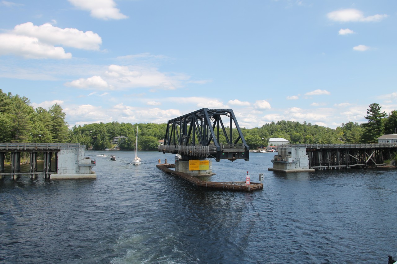


The Island Queen is navigating the South Channel between Rose Point and Parry Island and has just passed the former Canadian National Railways swing bridge at Mile 4.9 Depot Harbor Subdivision. The bridge commonly known as the "Rose Point Swing Bridge" was built by the Ottawa, Arnpior and Parry Sound Railway in 1912, the bridge no longer carries rail traffic. Known officially as the Wasauksing Swing Bridge the bridge is owned by the Canadian Government and provides the only road access to Parry Island. Studies to replace the present structure have been underway for several years.
Copyright Notice: This image ©Terry O'Shell all rights reserved.


Caption: The Island Queen is navigating the South Channel between Rose Point and Parry Island and has just passed the former Canadian National Railways swing bridge at Mile 4.9 Depot Harbor Subdivision. The bridge commonly known as the "Rose Point Swing Bridge" was built by the Ottawa, Arnpior and Parry Sound Railway in 1912, the bridge no longer carries rail traffic. Known officially as the Wasauksing Swing Bridge the bridge is owned by the Canadian Government and provides the only road access to Parry Island. Studies to replace the present structure have been underway for several years.

Photographer:
Terry O'Shell [127] (more) (contact)
Date: 07/27/2022 (search)
Railway: Canadian National (search)
Reporting Marks: Not Provided
Train Symbol: Not Provided
Subdivision/SNS: Mile 4.9 Depot Harbor Subdivision (search)
City/Town: Rose Point (search)
Province: Ontario (search)
Share Link: http://www.railpictures.ca/?attachment_id=49840
Click here to Log-in or Register and add your vote.

8 Favourites
Photographers like Gold.Log-in or Register to show appreciation
View count: 560 Views

Share this image on Facebook, Twitter or email using the icons below
Photo ID: 48555

Map courtesy of Open Street Map

Full size | Suncalc
Note: Read why maps changed. Suncalc.net for reference only.

All comments must be positive in nature and abide by site rules. Anything else may be removed without warning.
No comments yet, be the first by adding yours below

Railpictures.ca © 2006-2023 all rights reserved. Photographs are copyright of the photographer and used with permission
Terms and conditions | About us