Welcome Visitor. First time here? Like what you see? Bookmark us for when you are bored, and check out 'top shots' and 'fantastic (editors choice)' in the menu above, you won't be dissapointed. Join our community! click here to sign up for an account today. Sick of this message? Get rid of it by logging-in here.


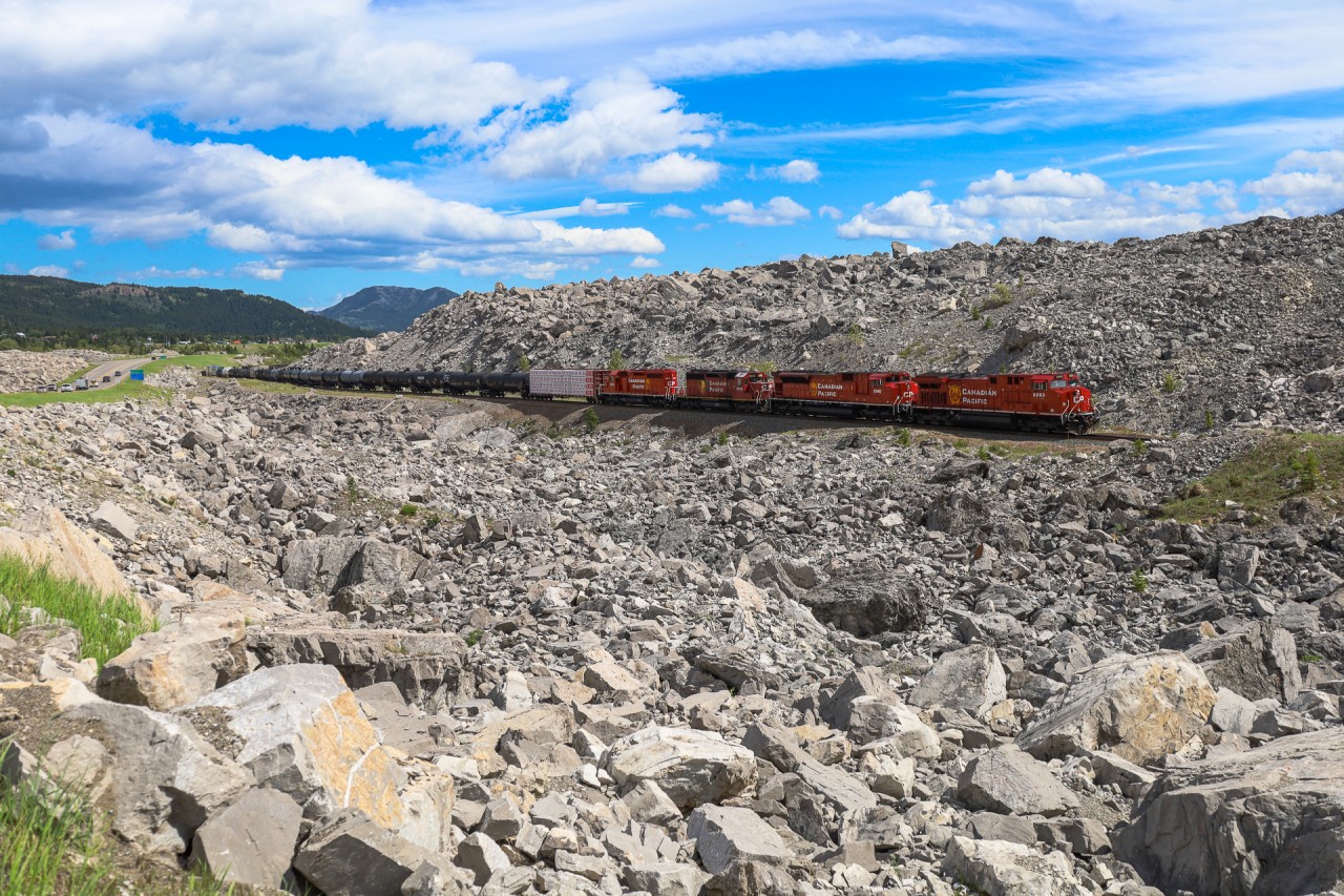
This has to be one of the most awe-inspiring places that I have ever been.  I had heard of Frank Slide before and seen photos, but I did not imagine the devastation was as wide spread as it was and that the rocks extended this far into the valley.  The place is surreal.  Just a short walk from the highway and you'll see anything from massive boulders, to tiny stones and pieces coal scattered around.  It is definitely worth the visit.  119 years after the devastating slide, we see CP 219 with CP 8000, CP 7046, CP 5792 and CP 5973, with CN 3905 on the tailend, climbing through the debris field at Frank Slide.  

In the early morning hours of April 29, 1903 the peaceful mountain town of Frank, Alberta was awakened by the thunderous sound of a rock slide on Turtle Mountain.  Within 100 seconds, 110 million tons of rock fell into the valley below at speeds approaching 70 miles an hour.  When it was all said and done, over 90 people had lost their lives and 3 square kilometers of the valley were buried by rock averaging 46ft deep, with some places being buried 150ft deep.  At the time, this was the largest recorded land slide in Canadian History and the CP mainline was buried for approximately 1.2 miles.  Within 3 weeks the railway had blasted a path through and re-opened the Crowsnest Sub. The eastern end of Frank, Alberta was devastated by the slide and the town was relocated out of the path of Turtle Mountain.  The mountain has since been outfitted with sensors, to monitor it for any signs of movement, as scientists believe it is only a matter of time before Turtle Mountain gives way and another massive landslide affects the valley.
Copyright Notice: This image ©Rob Eull all rights reserved.


Caption: This has to be one of the most awe-inspiring places that I have ever been. I had heard of Frank Slide before and seen photos, but I did not imagine the devastation was as wide spread as it was and that the rocks extended this far into the valley. The place is surreal. Just a short walk from the highway and you'll see anything from massive boulders, to tiny stones and pieces coal scattered around. It is definitely worth the visit. 119 years after the devastating slide, we see CP 219 with CP 8000, CP 7046, CP 5792 and CP 5973, with CN 3905 on the tailend, climbing through the debris field at Frank Slide. In the early morning hours of April 29, 1903 the peaceful mountain town of Frank, Alberta was awakened by the thunderous sound of a rock slide on Turtle Mountain. Within 100 seconds, 110 million tons of rock fell into the valley below at speeds approaching 70 miles an hour. When it was all said and done, over 90 people had lost their lives and 3 square kilometers of the valley were buried by rock averaging 46ft deep, with some places being buried 150ft deep. At the time, this was the largest recorded land slide in Canadian History and the CP mainline was buried for approximately 1.2 miles. Within 3 weeks the railway had blasted a path through and re-opened the Crowsnest Sub. The eastern end of Frank, Alberta was devastated by the slide and the town was relocated out of the path of Turtle Mountain. The mountain has since been outfitted with sensors, to monitor it for any signs of movement, as scientists believe it is only a matter of time before Turtle Mountain gives way and another massive landslide affects the valley.

Photographer:
Rob Eull [643] (more) (contact)
Date: 06/29/2022 (search)
Railway: Canadian Pacific (search)
Reporting Marks: CP 8000 (search)
Train Symbol: CP 219 (search)
Subdivision/SNS: Frank Slide - CP Crowsnest Sub (search)
City/Town: Frank (search)
Province: Alberta (search)
Share Link: http://www.railpictures.ca/?attachment_id=49205
Click here to Log-in or Register and add your vote.

16 Favourites
Photographers like Gold.Log-in or Register to show appreciation
View count: 876 Views

Share this image on Facebook, Twitter or email using the icons below
Photo ID: 47930

Map courtesy of Open Street Map

Full size | Suncalc
Note: Read why maps changed. Suncalc.net for reference only.

All comments must be positive in nature and abide by site rules. Anything else may be removed without warning.

One Comment
  1. Wow. Good angle to show jut how massive the slide was.

Railpictures.ca © 2006-2023 all rights reserved. Photographs are copyright of the photographer and used with permission
Terms and conditions | About us