Welcome Visitor. First time here? Like what you see? Bookmark us for when you are bored, and check out 'top shots' and 'fantastic (editors choice)' in the menu above, you won't be dissapointed. Join our community! click here to sign up for an account today. Sick of this message? Get rid of it by logging-in here.


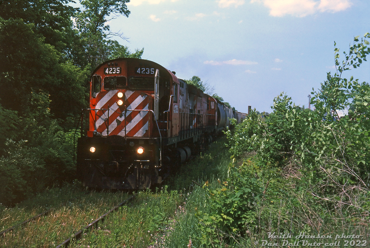
CP C424 4235 and a sister unit prowl the weed-grown Prescott Subdivision at the end of the line in the small hamlet of Oxford Station, working a local wayfreight that likely originating at Ottawa's Walkley Yard. This is the southernmost end of the line, and they're presumably here to work the local agricultural customer hidden by the weeds. CP's C424 fleet, rebuilt in the early 80's as "DRS" roadswitcher power with the addition of rear pilots, numberboards and dual headlights (previously "DRF" mainline freight units) were common branchline power on CP's eastern lines in the 80's and 90's.

The CP Prescott Sub was initially opened as the Bytown and Prescott Railway (B&PR) from Ottawa to the harbour in Prescott in 1855. It crossed the CP Winchester Sub (old Ottawa & Quebec line) at the diamond in Bedell. The southern section from Oxford to Prescott was abandoned 1995, and the last run from Walkley Yard to Bedell was made later in November 1997 before most of the north end was abandoned (much became a walking trail). 

At the north end of the line in Ottawa, part of the line is still in use by the O-Train and to access the National Research Council's facility. Remaining sections became spurs around Bedell to serve the few remaining customers: the North Prescott Spur from Bedell to Kemptville (abandoned in the mid-2010's, now too a walking trail) and the South Prescott Spur (today serving a lone agricultural customer at Oxford Station, Harvex Agromart).

Keith Hansen photo, Dan Dell'Unto collection slide.
Copyright Notice: This image ©Keith Hansen photo, Dan Dell'Unto coll. all rights reserved.


Caption: CP C424 4235 and a sister unit prowl the weed-grown Prescott Subdivision at the end of the line in the small hamlet of Oxford Station, working a local wayfreight that likely originating at Ottawa's Walkley Yard. This is the southernmost end of the line, and they're presumably here to work the local agricultural customer hidden by the weeds. CP's C424 fleet, rebuilt in the early 80's as "DRS" roadswitcher power with the addition of rear pilots, numberboards and dual headlights (previously "DRF" mainline freight units) were common branchline power on CP's eastern lines in the 80's and 90's.

The CP Prescott Sub was initially opened as the Bytown and Prescott Railway (B&PR) from Ottawa to the harbour in Prescott in 1855. It crossed the CP Winchester Sub (old Ottawa & Quebec line) at the diamond in Bedell. The southern section from Oxford Station to Prescott was abandoned 1995, and the last run from Walkley Yard to Bedell was made later in November 1997 before most of the north end was abandoned (much became a walking trail).

At the north end of the line in Ottawa, part of the line is still in use by the O-Train and to access the National Research Council's facility. Remaining sections became spurs around Bedell to serve the few remaining customers: the North Prescott Spur from Bedell to Kemptville (abandoned in the mid-2010's, now too a walking trail) and the South Prescott Spur from Bedell to Oxford Station (today still serving a lone agricultural customer near the end of the line, Harvex Agromart).

Keith Hansen photo, Dan Dell'Unto collection slide.

Photographer:
Keith Hansen photo, Dan Dell'Unto coll. [930] (more) (contact)
Date: Circa July 1997 (search)
Railway: Canadian Pacific (search)
Reporting Marks: CP 4235 (search)
Train Symbol: Not Provided
Subdivision/SNS: Oxford Station - CP Prescott Sub (search)
City/Town: Oxford Station (search)
Province: Ontario (search)
Share Link: http://www.railpictures.ca/?attachment_id=48999
Click here to Log-in or Register and add your vote.

20 Favourites
Photographers like Gold.Log-in or Register to show appreciation
View count: 1042 Views

Share this image on Facebook, Twitter or email using the icons below
Photo ID: 47725

Map courtesy of Open Street Map

Full size | Suncalc
Note: Read why maps changed. Suncalc.net for reference only.

All comments must be positive in nature and abide by site rules. Anything else may be removed without warning.

One Comment
  1. This is really cool.

Railpictures.ca © 2006-2023 all rights reserved. Photographs are copyright of the photographer and used with permission
Terms and conditions | About us