
Welcome Visitor. First time here? Like what you see? Bookmark us for when you are bored, and check out 'top shots' and 'fantastic (editors choice)' in the menu above, you won't be dissapointed. Join our community!
click here to sign up for an account today. Sick of this message? Get rid of it by
logging-in here.

Great history Arnold, but I feel this photo is the ‘pits’ (***groan****)….never heard of H&D before though….also, knew that the TH&B ran in Dundas, again…it was all removed by the time i took further interest in the TH&B late 90s.
Todd: Some rather significant information is found on-line regarding the old Hamilton & Dundas railroad. Once you start digging into the historical world of railroads in Ontario’s South-west; the reading is endless.
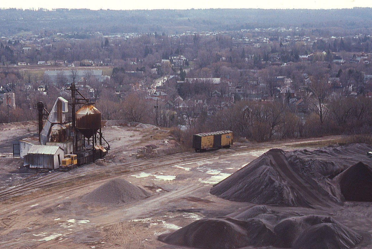
Looking at Openrailwaymap.org Arnold. Did the TH&B spur run from Osler to Hatt St? And where did it end up at Steetley Quarry? I like the little tonner they used for switching there.
Brad, I vaguely remember the line. It went along Osler, along Hatt; and then swung over to Steetley as you see on the right hand side in the photo. As far as I know this was the limit of the Dundas Branch as you see here.
The Quarry operation was up on the hill and eventually as far as Hwy 5, where it still operates. The lower section you are seeing here is just for the most part just the finished product after it has gone thru the crusher and over the CN main via the conveyor. Four years prior to this photo the operation shut down except for up by Hwy 5 where everything goes out by truck. You are seeing here stockpiles that will eventually go our by rail car and that was the end of the operation at this location. The CN Dundas sub had a track which came off the main, down the grade, and connected with TH&B and Steetley facility track and back up to the CN main eastward. So, I’d consider the Dundas Branch ending by the Steetley connection you see here. I’ve posted a couple of other shots from this viewpoint but the structure of the conveyor, which was abandoned at the time, prevented a wide angle image.
This picture will be very much useful for my mapping project, great historical value!